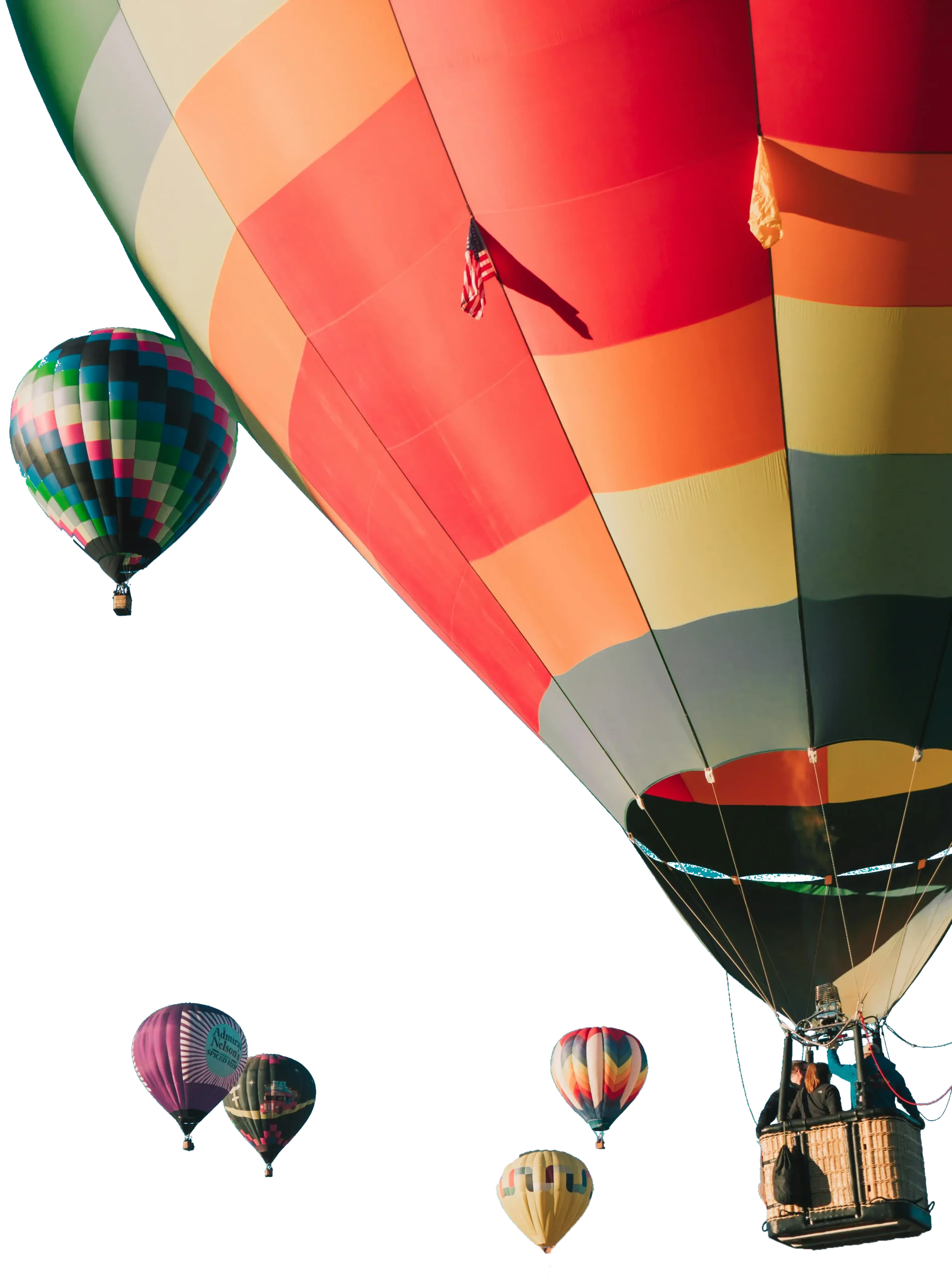
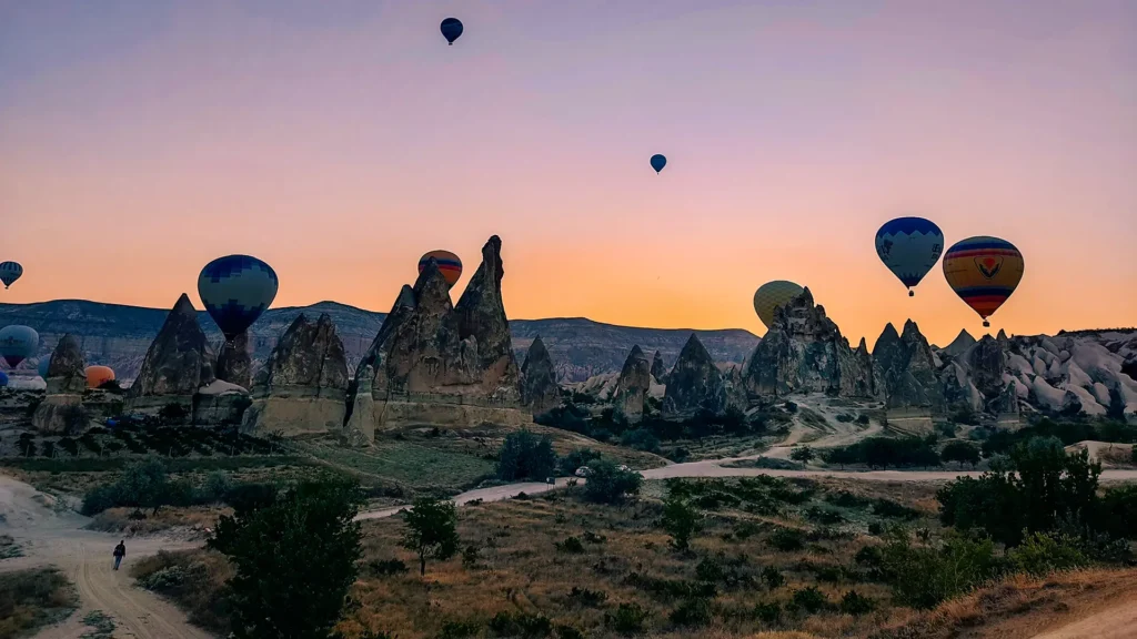
Cappadocia hot air balloon flights cover four main valleys: Rose Valley, Love Valley, Meskendir Valley, and Zemi Valley — plus Pigeon Valley and Devrent on longer or repositioned routes. I’ve walked every one of these valleys on foot across 15 years of guiding, and the aerial view changes what you understand about them completely. So, which valleys do Cappadocia hot air balloons fly over? This guide explains what’s in each one, what it looks like from 300 meters up, and why Cappadocia’s geology makes these particular corridors the best place on earth for balloon flight.
Why Valleys — Not Open Plains
Most balloon destinations in the world fly over flat terrain. Cappadocia is unusual because the landscape is defined by valleys — erosion corridors cut into a volcanic plateau over millions of years. Flying over Cappadocia means flying over this valley network at low altitude, which is fundamentally different from floating over, say, the Nile Valley or the Serengeti.
The balloon doesn’t just give you elevation. It gives you a geological cross-section. You see the caprock layers sitting on soft tuff columns, the cave openings cut into cliff faces by Byzantine monks, the colour gradient from red iron-rich soil in one valley to white sodium-rich tuff in another — all of it spread below you within a 10-kilometre radius.
SHGM licenses Cappadocia balloon flights within a defined airspace zone centred roughly on Göreme. This means all operators fly over roughly the same valley network. What differs between operators isn’t which valleys you see — it’s altitude management, basket size, and how much time your pilot spends letting you hover low versus climbing high for the panoramic view.
*Yusuf Demir has guided ground tours through all four primary valleys and coordinates balloon flights with licensed Cappadocia operators.*
Rose Valley (Güllüdere Vadisi)
Rose Valley is the most recognizable from the air, and the one most likely to appear in any photograph taken from a balloon. The name comes from the iron oxide in the tuff — the rock takes on a pinkish-red tone in the early morning light that is difficult to describe accurately to someone who hasn’t seen it. From above, it reads as a deep orange-red corridor cutting roughly east to west between Çavuşin and Ortahisar.
What makes Rose Valley distinctive from the air:
The rock columns. These are the classic “fairy chimney” formations — soft volcanic tuff capped by harder basalt, eroded into columns 10–25 metres tall. From the basket, at the right altitude, you can look down into the gaps between them.
The cave churches. Rose Valley contains at least four Byzantine rock-cut churches — Haçlı Kilise, Kolonlu Kilise, and others carved directly into the cliff faces. From the air, you can see the openings and understand the logic of their placement in a way that’s impossible from the valley floor.
The colour shift. At golden hour — the first 20–30 minutes after sunrise — the iron oxide in the rock saturates. Photographers specifically plan balloon flights for this window. By 8 AM, the effect fades.
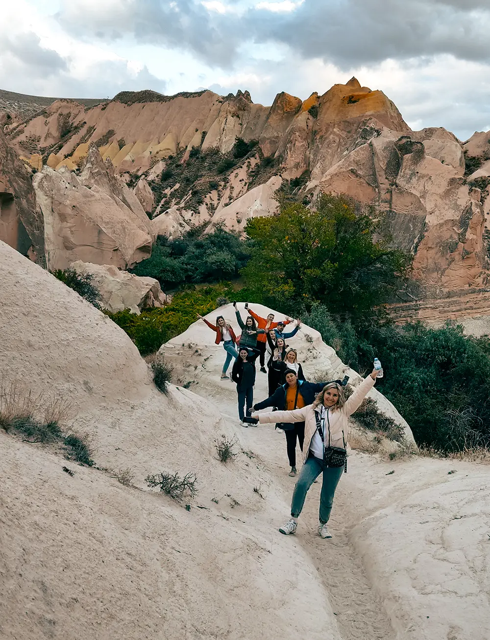
On foot, Rose Valley takes 2–3 hours to cross. From the air, your balloon covers it in 10–15 minutes at low altitude, or you can watch it recede below you as you climb. Most pilots will hover over the valley mouth before transitioning east.
Love Valley (Aşk Vadisi)
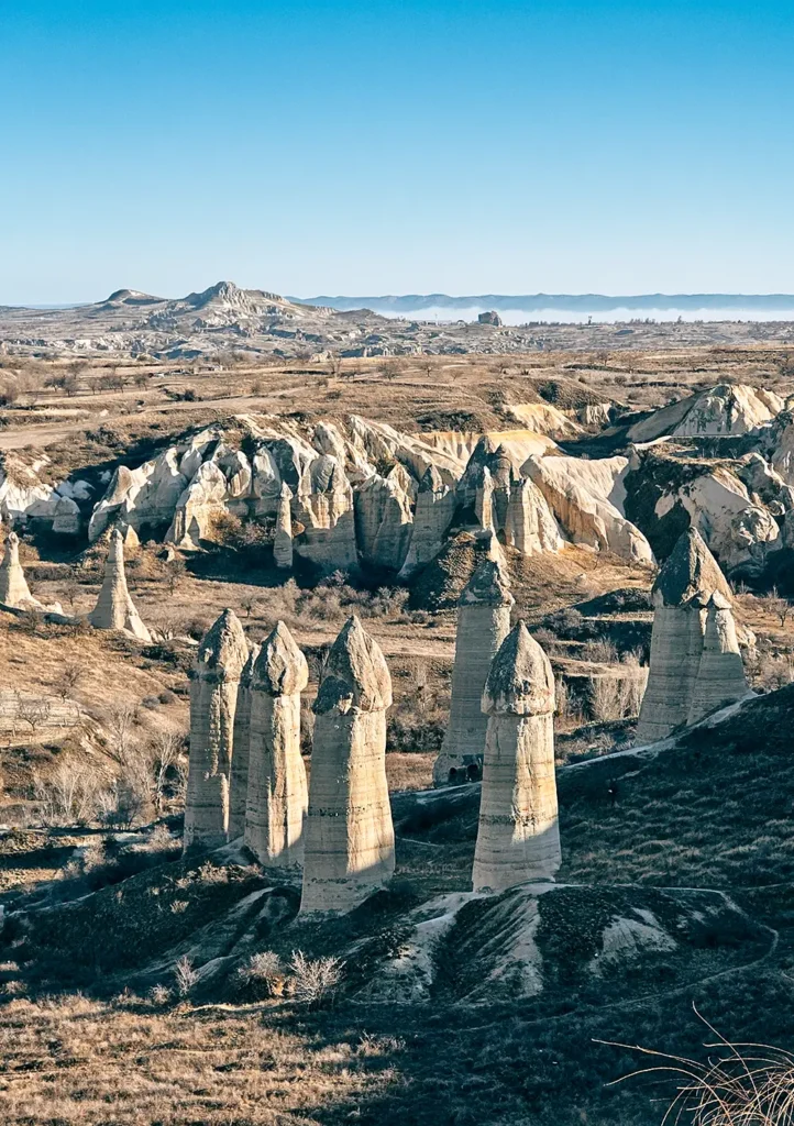
Love Valley lies northwest of Göreme, and it produces the most recognizable silhouette in Cappadocia’s promotional photography — the tall, cylindrical rock formations that have made it a social media landmark. I’ll be direct: the name is tourist-era branding, coined sometime in the 1990s. The geological process that formed these columns is identical to Rose Valley; the difference is the rock composition, which produces taller, more uniform columns rather than capped fairy chimneys.
From the air, Love Valley looks like this: a dense cluster of vertical columns, some reaching 30–40 metres, arranged in rough rows along the valley floor. The scale becomes apparent when you see people walking the valley path below — tiny figures moving between formations that dwarf them.
Balloon pilots often position over Love Valley during the early part of the flight, while the air is still calm and low-altitude hovering is possible. The view looking straight down into the column cluster is one of the most-photographed balloon shots in Cappadocia.
Geologically, Love Valley represents a zone where the tuff was denser and more homogeneous — producing these elongated columns rather than the mushroom-cap shapes that require a harder caprock. The columns here will continue eroding until they collapse entirely. Some of the formations you see today didn’t exist in the same form when I started guiding here 15 years ago.
Meskendir Valley
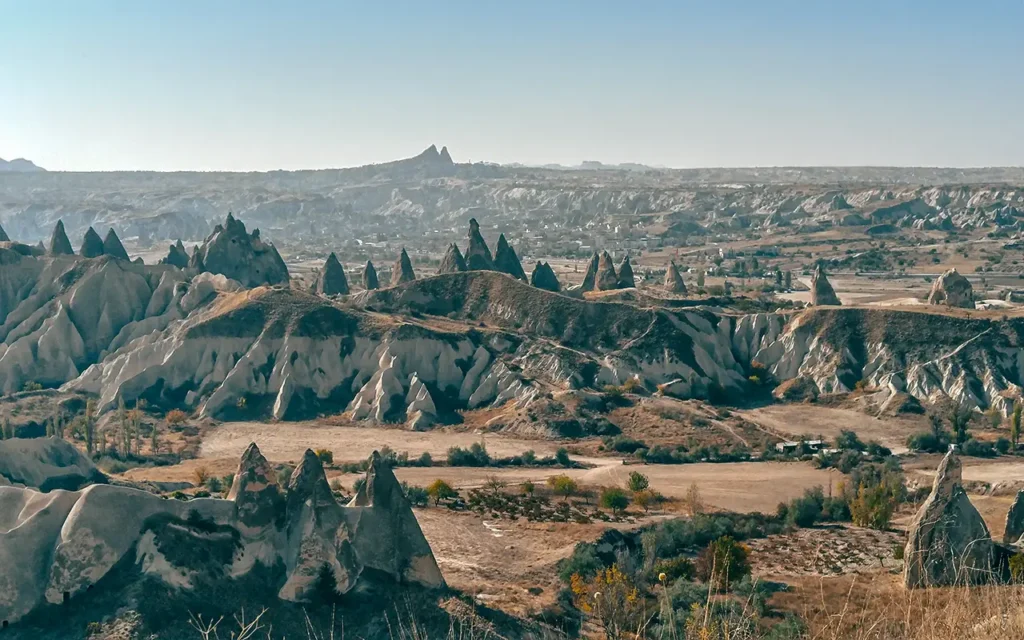
Meskendir is the valley that most visitors walk past on the way to Rose Valley without realizing it has a separate name. It runs roughly parallel to Rose Valley on the northern side, separated by a ridge. From the air, the distinction becomes clear.
What Meskendir offers that other valleys don’t:
Layered stratigraphy. The cliff walls in Meskendir show multiple distinct volcanic layers — different eruptions at different times, each with its own color and texture. From a balloon, at the right angle with morning light, you can read these layers like a geological timeline.
Fewer tourists. Meskendir sees a fraction of the foot traffic of Rose Valley. From the air, this means the valley floor below you is likely empty — no tour groups, no paths. Just rock and the occasional pigeon.
Cave storage rooms. The lower cliff faces in Meskendir are cut with Byzantine-era storage chambers and dovecotes (pigeon houses — niches cut to attract pigeons, whose guano was used as fertilizer). From the air, these appear as regular grids of holes in the cliff face. It looks architectural from above, which surprises people.
Balloon pilots typically pass over Meskendir as part of the transition between Rose Valley and the Göreme plateau, or use it for low-altitude hovering when wind conditions allow.
Zemi Valley
Zemi Valley sits southeast of Göreme, and it’s the least discussed of the four primary balloon valleys — which is precisely why I want to describe it here. Zemi is narrower than Rose Valley and less dramatic in scale than Love Valley, but it has two characteristics that make it memorable from the air.
First, the cave dwellings. Zemi contains some of the best-preserved examples of inhabited cave architecture in Cappadocia — rooms carved across multiple levels into the cliff face, connected by internal staircases that are invisible from below. From a balloon at 100–150 metres, you can see the full vertical extent of these structures. You understand immediately that this was a functioning settlement, not just a series of isolated rooms.
Second, the vine terraces. The lower slopes of Zemi Valley are — or were, in different periods — cultivated with grapes and fruit trees. Some of these terrace cuts remain visible in the rock. Cappadocia has been wine-producing territory since at least the Hittite period, and Zemi is one of the places where you can see the agricultural history written into the landscape.
On busy balloon mornings with 100+ balloons in the air, Zemi is sometimes used as an alternative approach corridor to avoid congestion over Rose Valley. If your pilot takes you over Zemi first, that’s a sign they know the airspace well — it’s not a lesser option.
Pigeon Valley (Güvercinlik Vadisi)
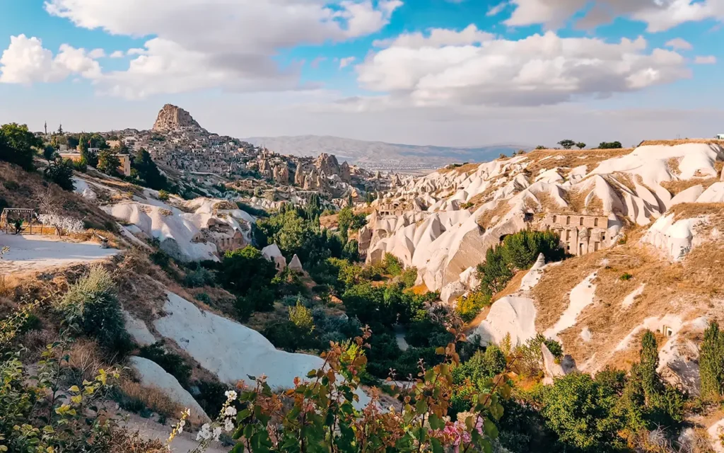
Pigeon Valley connects Göreme and Uçhisar, and it’s the valley most visible to tourists because the main road runs alongside it. It’s included in many balloon routes, particularly on flights that drift west toward Uçhisar Castle.
The name comes from the thousands of dovecotes cut into the valley walls — the same type of pigeon-keeping infrastructure I mentioned in Meskendir, but here on a much larger scale. From the air, the sheer density of these cut niches makes the cliff faces look almost lace-like.
Uçhisar Castle — the highest natural rock formation in Cappadocia — is usually visible from the air even on flights centred over Rose Valley. When wind conditions carry the balloon west, Pigeon Valley and Uçhisar form the western boundary of the flight zone.
Devrent Valley (Hayal Vadisi / Imagination Valley)
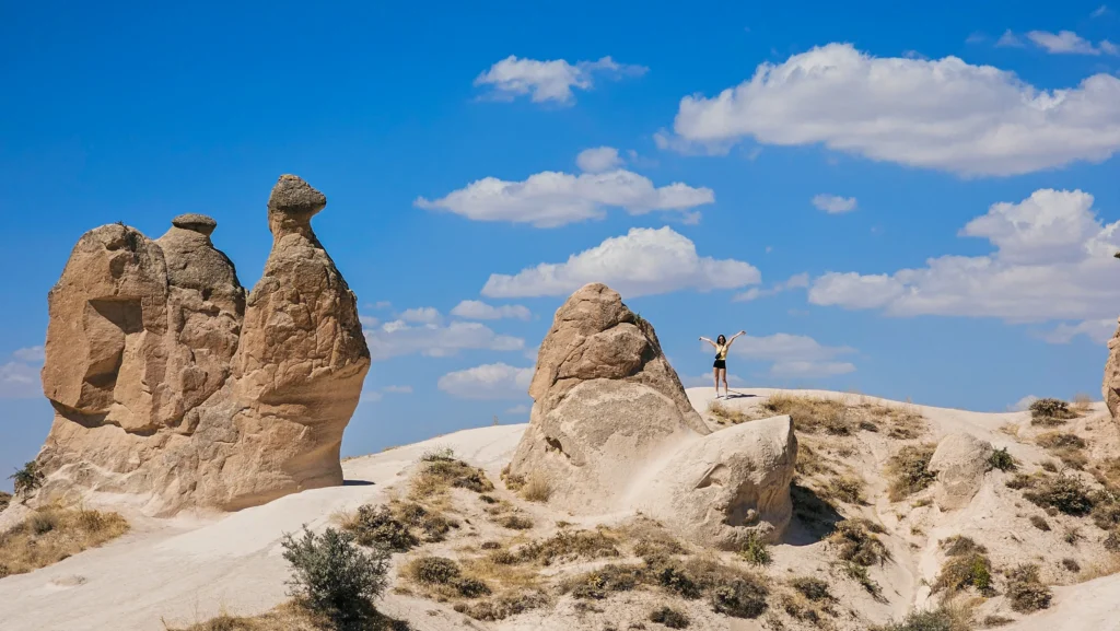
Devrent sits northeast of Avanos and is slightly outside the core balloon zone, but it appears as a backdrop on clear days or on flights where a strong easterly carries the balloon further than usual. It’s known for isolated rock formations in unusual shapes — the “camel formation” is the most photographed. From the air, the broader volcanic plateau context makes these isolated shapes look like they were placed there deliberately, which of course they weren’t.
Most flights don’t hover over Devrent. It’s more commonly seen at distance while the balloon is at altitude over the main valley network.
Why Cappadocia’s Geology Makes This Possible
I want to explain one thing that travel content almost never addresses: why these specific valleys exist where they do, and why that makes them suitable for ballooning.
Cappadocia’s landscape was created by a sequence of volcanic eruptions — primarily from Erciyes, Hasandağ, and Güllüdağ volcanoes — that deposited thick layers of tuff (compressed volcanic ash) across the plateau. Over millions of years, water erosion cut through this plateau along lines of weakness, creating the valley network. The tuff eroded faster than the basalt caprock above it, producing the fairy chimney shapes.
The result is a plateau at roughly 1,100–1,200 metres elevation, cut by valleys that drop 100–200 metres below the plateau surface. This plateau-valley geometry creates consistent, laminar airflow in the mornings — air drains off the plateau into the valleys at a predictable rate as the sun warms the rock. This is why balloon pilots can manage altitude so precisely here: the airflow behaves in ways that can be anticipated.
It’s also why flights are conducted exclusively in the morning. By 8–9 AM, solar heating of the dark volcanic rock creates thermal instability that makes low-altitude hovering unpredictable. The narrow window between first light and thermal development is the window Cappadocia uses.
Cappadocia’s volcanic plateau [provides] consistent laminar morning airflow [that] makes low-altitude balloon hovering possible in ways that flat terrain cannot replicate.
What You Actually See: The Flight Arc
A typical 60-minute flight follows a rough arc:
- Launch — from one of several fields near Göreme. Pre-dawn inflation, then a slow rise as light builds.
- Valley entry — usually Rose Valley or Love Valley first, at 50–150 metres, depending on wind and congestion.
- Mid-flight repositioning — altitude gain to 300–500 metres to drift with upper airflow, giving panoramic views of the entire valley network.
- Low-altitude hovering — pilots bring balloons back down into a specific valley when conditions allow. This is the most technically demanding part of the flight.
- Landing — chase crew tracks via radio from the roads above. Landing zones vary; the plateau above the valleys is used most often.
Please check today’s balloon fligt status before you book.
Ready to fly over these valleys? Book your Cappadocia hot air balloon flight directly with a TURSAB-licensed local operator — hotel transfer and breakfast included.
FAQ — Which Valleys Do Cappadocia Hot Air Balloons Fly Over
Which valleys does a Cappadocia hot air balloon fly over?
The four primary valleys in a standard Cappadocia balloon route are Rose Valley (Güllüdere), Love Valley (Aşk Vadisi), Meskendir Valley, and Zemi Valley. Pigeon Valley and Devrent Valley are often visible at altitude and sometimes included depending on wind direction.
Do all Cappadocia balloon operators fly over the same valleys?
Yes — SHGM licenses balloon operations within a defined airspace zone around Göreme. All operators fly over roughly the same valley network. The differences between operators are basket size, altitude management, and pilot experience — not the valleys themselves.
Can you request which valley the balloon flies over?
No. Flight paths are determined by wind direction and airspace management on the morning of the flight. Pilots aim for the primary valley cluster, but cannot guarantee a specific valley. What you can expect: all four main valleys are typically covered in a standard 60-minute flight.
What is the best valley to see from a Cappadocia balloon?
Rose Valley in the first 30 minutes after sunrise produces the most visually striking results — the iron oxide rock saturates to a deep red-orange in that light. Love Valley's column formations are the most geometrically dramatic. For historical detail, Zemi Valley's cave architecture is unmatched.
How high does the Cappadocia balloon fly over the valleys?
Low-altitude hovering over the valleys happens at 50–150 metres above the valley floor. Mid-flight altitude for repositioning is typically 300–500 metres above the plateau. The highest point of the flight, for panoramic views, can reach 600–1,000 metres above ground level on calm mornings.
Yusuf Demir
Professional Tour Guide | Archaeology | History | Art
He has led more than 3,800 tours across Turkey — from the underground cities of Cappadocia to the marble streets of Ephesus. He also spent a year working ground crew and operations at a Cappadocia balloon company — he knows firsthand how SHGM makes pre-dawn flight decisions and what pilots look for before launch. His academic background in Archaeology, Art History, and History of Religions shapes every itinerary he designs. This guide reflects what he actually tells people on the ground, not what looks good on a brochure.